Stage 10. Vigo – Caldas de Reis
Vigo – Caldas de Reis
63 Kms
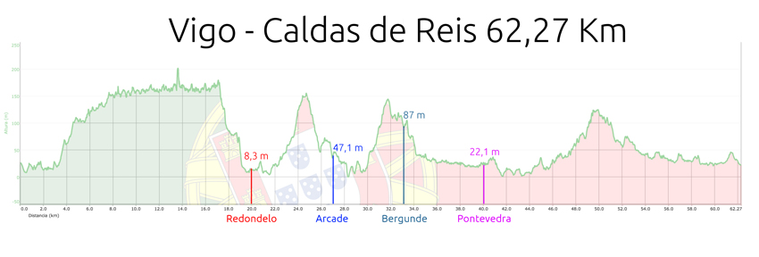
We started our stage where we left it yesterday.
If we are at the HESPERIA VIGO hotel, all we have to do is look for the Celta de Vigo stadium and turn left to reach the gray fence that follows the perimeter of the car factory and the alley where in the previous stage we leave the path.
We go up the avenue until we bump into a roundabout and a park in front, we turn left and soon we will see an access at the gate of the park that we must cross to walk inside this landscaped area.
From within the same park we will follow the arrows of the road and we will access some dirt trails that next to a stream and uphill will take us to the URBANIZACIÓN COLINA DE CASTRELOS.
Before one of the trails in the park that will allow us to pass underneath a road (quite a hit).
We are following a river channel through a wooded area.
We will go out on a road with a ramp down a steep street in front of us… if we are not attentive to safety, here we will get lost and we will not find the road signs… we must look to the left, go down a few meters and a dirt path like the one we brought continues along the river bank between trees and upwards.
This path in the shade of the trees will pass us through a few wooden walkways or bridges… the path will leave us on a small paved road, to our left a tunnel saves the road below (we will head there).
Between houses we begin to climb a hill and when we reach the top we turn left to advance along a somewhat more civilized street with more atmosphere. We pass in front of a church of modern construction (we leave it on our right) and we advance to turn left at the end of the street. Immediately we will have to turn again to the right and we will advance straight ahead towards a two-way road with a lot of traffic. A traffic light regulates the traffic and will stop the cars to cross, but also be very careful because the area is dangerous.
Shortly after passing we will have to take a street with flagstones (pedestrian type) up and with a sign forbidden to pass in front of us. We are bordering the Hermitage of San Roque, we reached the top after passing some stairs and we went out onto the asphalt. From there we take an uphill street to our right… we advance more or less straight and passing several intersections. We are in a tangle of streets of a big city and for our tranquility we will always have the yellow arrows for lampposts, walls, sidewalks… etc. But we will be obliged to move forward with great caution so as not to get lost or leave any sign behind.
Be careful, as in many other places and here, as it is a great city, is getting worse, we will have some streets that will have to be crossed in a prohibited direction with cars that come dangerously towards us. If it is necessary to get off the bike and walk on the sidewalk as pedestrians.
Here in this area there is much more atmosphere of a big city, much more transfer of cars and everything is somewhat more chaotic.
I insist a lot of care… there will be several sudden left and right turns between large avenues that we cannot narrate here so as not to mislead you even more as they are continuous… it is an authentic obstacle course and leaving this city will suppose us a great waste of time.
In this transfer of streets to orient ourselves a little, we will go through a pedestrian street (a sign prohibiting the passage of vehicles and only loading and unloading), Rua Urzaiz, which we will recognize because it is a street with flower beds, boulevards and shops…
A little before the end of this pedestrian street we turn left and take a street in front and up. We advance and in front we already see some mountains with eucalyptus and somewhat more open spaces. We are going to leave VIGO as we enter houses and housing estates, but getting away from the city, the traffic lights and the kind of chaos that is traffic will be a relief.
In addition, not everything will be disadvantages… in this transfer and advance through the city we will gain height and climb the side of a mountain through which we will advance seeing the estuary to our left (beautiful views) and without both go up and down.
So we move along these urbanization streets and in a logical sense for us (towards the north), now we can relax a bit.
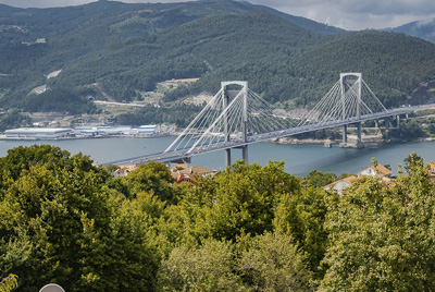
On our left we will see beautiful views of the city, the port, the estuary as we mentioned before and in the background a modern white bridge (PUENTE DE RANDE) that we will surely stop to photograph.
Arrived in this area we will do one thing to clarify an issue that is important that you must take into account.
In case VIGO was not chaotic enough to orient yourself and cross it, there is also an alternative route that someone depends on where you stay or on a street taking an arrow that is not… it may be that you follow that alternative route arrows and moving confidently thinking that you are on the right path and the path we describe in this guide.
If that happens these people who go through the alternative route will advance through the lower part of VIGO and next to the port and the sea… you will go north on a road and so you will not be passing by this half-skirted mountain height with panoramic views that we are describing.
If it were like this, don’t worry… keep going with the road signs that will take you without loss and a little before reaching the majestic and imposing Rande bridge, you will have to turn off onto a road to the right that will go up the road and you will arrive at a point where the signs will take you out through some impressive ramps. I think that more than one will have to walk up them, it is a brutal drop!! After those ramps you reach the average altitude of the hillside, you will bump into a sign indicating “A TRAIDA” and there you are already turning left on the common route and which is the one we are narrating in this guide.
We accompany this description with a track of the GPS route that we have prepared and thoroughly reviewed and that if you lean on it you will have no problem. We have marked a waipoint with the point where both alternatives are found.
The use of GPS on this route or applications for the WIKILOC mobile phone is highly recommended.
Let’s continue where we stayed before explaining this topic of the alternative path of the port… we are moving north on the side of a mountain and with beautiful views to our left and thus we will travel a few kilometers…
There is no loss, the direction will always be the same and although we cross several crossings and streets up or down, we continue straight, north and parallel to the sea.
We will arrive at a kind of green area or picnic area… a little earlier, the alternative path has been incorporated that will have been followed by those who made a mistake in VIGO.
We will be passing through an area where trees and forests abound more than houses (it is appreciated).
We will reach a point where large stones sweep the road to the cars and the road for a small section will be dirt, at a bend we go out onto the asphalt again.
We continue advancing and when we reach the height of the majestic bridge (we will see it to our left in the estuary) the path will make us cross a wooded area and soon leave us again in an area of clear views and houses.
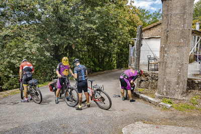
Next to the fence of a house we go to the right and we touch the ground but we continue with our north direction, down the side of the mountain and parallel to the estuary.
A nice and placid dirt path will make us move forward on this pleasant path for bicycles… we are traveling on a route well known in the area and very frequented, in addition to pilgrims by runners and hikers (LA RUTA DA AUGA ).
They come 5 kilometers fun and downhill to REDONDELA that will make us relax and enjoy our bike through some beautiful forests with beautiful views.
In REDONDELA where we arrived after a dizzying descent, the two routes of the Portuguese road that leave OPORTO and that gave us the option of taking the coast or the central (or inland) road meet right at the entrance of the population and here we will see more movement of pilgrims and people on the way. From this point we will be more accompanied.
In the anteroom of REDONDELA and just as we descend to the valley, we find the church of SAN ANDRÉS, which we can visit, to continue along narrow tracks between houses and orchards. We continue to go down and pass underneath the train tracks, Immediately afterwards we will access a large road (the N-552) that we must take on our right.
We keep going down the road and when we get to the roundabout we turn left towards the city center. Right there is a bar with a small terrace that is where several times we stop to have a drink and regain strength before continuing on our way. Remember that on the way you have to hydrate and eat 😉
We will enter the streets of REDONDELA taking care not to miss the arrows… it is a bustling city with narrow streets. It is impressive to see how in the heart of the city the train literally passes over the houses.
In the heart of REDONDELA and in a wide square with a roaring river that runs through the center is the REDONDELA HOSTEL (Casa da Torre), a little further up following that square is the HOSTEL A CASA DA HERBA, we will pass by in front of this hostel in a large house in a secluded plaza… here we have already started to move away from the river and go back up narrow alleys until we reach a large bridge that allows the train to pass from above and that we will pass below.
We will access a small roundabout and in front we will catch a glimpse of a small church and just ahead we have a road, we have to turn right along that road but be careful, we must immediately exit diagonally to the left, we are not going to continue along this road, but we will immediately turn aside to leave the city next to the river and through the sports area.
We are already leaving REDONDELA behind (kilometer 20 of our stage) and we are moving towards country areas and houses. Galicia is a constant rise and fall and here we are already in the authentic and genuine Galician landscape… hills above and hills below, overcoming forests from time to time and scattered houses.
We head in this area until the ascent of one of these saw teeth, we have before us an ascent of about 4 kms. But do not worry, there is not a lot of unevenness and we will climb in a smooth way and on relatively calm asphalt roads.
On a ramp that begins to bite upwards, we will pass over the train tracks and at the sight of a house with large railings and white walls, we will drop to the left along a path of stone slabs and downhill. We will cross a small eucalyptus forest and we will access the asphalt little by little to continue climbing.
We arrive at the national highway (Beware very dangerous crossing), right at that road junction we have 2 bars, one on our left before crossing the road and another in a white house on the other side of the road (we recommend the first one , the one before crossing the road).
We will cross the road very carefully and follow our progress, we take the first street on the right, then on the left and we begin to climb towards a hill in front of us… in the middle of the street and before an iron fence that sweeps the I pass a farm, turn ninety degrees to the left and up a narrow street. At the bottom of the street we have a fountain (FONTE OR VISO).
After this source we take a dirt road. We will advance through a dense eucalyptus forest and we will cross a firewall with power lines. We will be entertained because we are going uphill. At the top we have an area where we can take beautiful photos of the Galician countryside with the estuary in the background. A nice and quiet dirt road with stunning views.
On the way down we leave the earth and access a narrow paved track that we take to the right. We will continue on a quick descent and through a wooded area that ends in a large esplanade next to the national road. We will advance along this road until we reach the first houses of ARCADE which is already close.
After 600 meters of traffic on this road, we cross the plate that gives entrance to the city of ARCADE and we are placing ourselves in the lane to turn left… we will soon see arrows and signs that take us off this road on our left, to immediately take an asphalt track to our right and downhill. (Be careful the descent is fast, the firm uneven and somewhat dangerous).
The descent is smoothed just as you pass in front of a laundry room and goes back to the road (we have made a small loop). We must cross the road (be very careful, we will arrive at the intersection without much visibility in change of grade)… when crossing we enter the center of ARCADE.
We will pass in front of the HOTEL DUARTE and we will carefully walk through this town, paying attention not to miss the road signs that we will see on walls and lampposts.
Walking through these narrow alleys we will end up in a wider avenue or highway type street… and we turn right. At the end of the street we find a traffic sign indicating PONTESAMPAIO, we must go there.
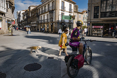
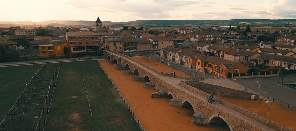
At the end of this downhill street with a sharp turn to the right, we suddenly hit an impressive bridge (the famous PONTESAMPAIO) that will give us the opportunity to take beautiful photos.
We will cross this bridge and this beautiful picture postcard and head towards what is supposed to be one of the hardest and most complicated parts of today’s stage. In front of us and on the other side of the river we have a very complicated area with hard climbs that we are going to face immediately. If we have not recovered our strength or we need to rest, take advantage of this last area next to the bridge, because later on it will be more complicated.
So as soon as we passed the bridge we started to climb upwards and shortly we turned to the left through an alley to go down a little at river level and turn sharply to the right again and make a sharp curve in plain on the VILLAGE OF SOUTO.
Just when we arrive in front of the Souto crossroads, we turn right uphill and take the asphalt until we reach a road that we cross and a very complicated section begins here and in some stretches “NOT CICLABLE”.
The famous section begins on a dirt path that we take down and that introduces us into a small valley (before the big climb). The advice is to take this area with some tranquility, climb quietly and get off the bike where necessary in order to avoid unnecessary risks. On any route of a few kilometers, lifting a wheel and jumping a stone can be exciting for us, but on a long-distance cycling route, falling for jumping a stone and having an injury can be fatal… therefore the advice is to climb carefully.
The dirt path on the first initial descent delivers against a stream and soon we will arrive at the walls of some industrial warehouses where we will begin to climb. Here the path is no longer a path… we are facing huge slabs or boulders (ancient Roman road) that we will have to save as if they were stairs. Arm yourself with patience and push up the bike.
In this area the alternative by road is not easy (we have already looked at it) and the return to avoid the stretch is very large. It would be possible to save this piece along the national highway, but we do not think it will be that bad either, because if you have patience and calmly push the bike, it is not a long stretch and it can be done.
In full ascent we will pass near the village of CACHEIRO and we will come out on a road that gives access to this small town. We will think: “buff, this is over”… and it will not be like that, the road we cross and we continue up the path with a hard slope, but luckily now it is already cyclable and if we have strength perhaps we can do it on the bicycle.
We will access asphalt and take a sharp curve to the right… we are heading towards the village of BERGUNDE which is at the top.
Upon reaching the top and next to a pine forest, we take a wide track to our left and immediately turn to the right along a beautiful forest track.
We will arrive at an area of vineyards and already at the top we will begin our transit through country houses and crops.
Here we have a relatively quiet area and, as we are used to following the road signs, we can advance without much concern for asphalt paths and relatively easy and smooth rolling country roads. We go through a valley area and preferably downhill.
We will arrive at some houses and we will cross a couple of carts with crosses through the village of (O ALCOUCE), when passing this village we will enter a beautiful dirt path through a eucalyptus forest. It will not be much of this stretch of forest and land and soon we will end up on an asphalt track (we turn right), we come to a road that we will cross and take a dirt road next to a huge electric pole.
Very beautiful and easy to pedal this area. Really around here we are going to pedal very quietly and we are going to enjoy the rural and rural landscape with forests and crops around us. We are approaching PONTEVEDRA and a very pleasant surprise awaits us a little further ahead.
We must be very careful not to miss a beautiful river path, with a twisted path (beautiful place) that will unbelievably deliver us against the first houses of the city of PONTEVEDRA… on few occasions I had the opportunity to approach a great city for such a nice and pretty place like this.
Thus, traveling between villages, cultivated fields and quiet asphalt tracks, we will arrive at a large road with a sign announcing the entrance to the CONCELLO DE PONTEVEDRA (next to the Santa Marta chapel), a STOP sign will stop and if we look to our left we will see the sign indicating the council.
We take the left and we must proceed very carefully… be careful not to pass!! A few meters away from traveling on this road we will arrive next to a large tree (on our left) and just at its base 2 signs for the Camino de Santiago. They will give us the possibilities to shoot to the right or to the left.
TO THE LEFT, TO THE LEFT!!!
Make no mistake, the trail on the left leads to a beautiful and very fun river trail… (SENDA FLUVIAL DEL RIO TOMEZA), the sensation of today’s stage that will leave us right at the entrance to PONTEVEDRA.
It is incredible how in a priori place so urbanized and close to a great city they have managed to preserve this natural space and this secluded and secluded corner of civilization, so close and so isolated. I congratulate those who preserved and conditioned this beautiful route.
In its final section, this beautiful river path will allow us to cross underneath a large highway and the train tracks. It will deliver us against a paved road that we will have to take to the left and in a curve we will be in front of the BAR EL PEREGRINO… a highly recommended place because by the hours it usually coincides with the midday meal and we advise you to stop for a drink before facing the second part of the stage. This bar also has a pension in case someone decides to sleep or nap, who knows? ;).
Crossing the pilgrim’s bar and going up the street we will reach a roundabout that we cross straight and as soon as we cross it we take a street that comes out on the diagonal to the left of a statue that looks like a large and rusty candle. To get our bearings we will be right in front of the train station.
A narrow street will take us forward parallel to the great avenue of the train track that we have not taken (here we are more protected). But also with caution because we are going in the forbidden direction and we will have to be vigilant with cars that come our way.
Luckily this long street takes us deep into the city and brings us closer to the center. If someone wants to try and not go in the opposite direction, another option would be to continue up the avenue of the train station.
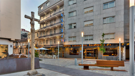
At the end of our long street and in a forbidden direction, we will reach the avenue and with a roundabout that we cross, we take a street in front of us. There are some stairs that we can go over on the left and we will pass in front of the VIRGEN DEL CAMINO HOTEL, (If someone plans to stop in Pontevedra this is a good place).
We enter by going over the stairs and passing in front of the hotel through a narrow street with bollards and uphill (luckily we are going in a good way of traffic). At the end of the street a traffic sign forces us to turn left, we do so and we immediately turn right, thus accessing a wide plaza and the entrance to a commercial and pedestrian street. We are reaching the center of PONTEVEDRA with its imposing square and its cathedral with a suggestive name “LA VIRGEN PEREGRINA”.
In this square there are some bars and terraces where we can refresh ourselves with a good beer…
We continue along a street in front that passes a large building that gives shape to the church square to access another large square behind (Plaza da Ferraría), here we turn left and continue moving down, small street with arcades, bifurcation to the right, and we continue through narrow streets (CALLE REAL) old area of PONTEVEDRA, narrow alley that descends into PLAZA CELSO GARCIA DE LA RIEGA, (Also known as Praza do Correo Velloy). In this square we take a left (RUA DA PONTE) which, as indicated, will leave us in front of PUENTE DO BURGO where we are going to cross the estuary and continue on our way.
Just as we pass the bridge, we cross a roundabout straight ahead and shortly after we take a street on the left, already uphill. A rule that does not usually fail… whenever we approach a river it is downhill, whenever we move away from a river it is uphill…
We find a roundabout and in front on the left a street in the forbidden direction that we take carefully .. (RUA SANTIÑA), it is a narrow street and the cars that we meet in front are not going to have much room to pass us .. , also does not have much visibility, Buff !! They should do something on the roads of Santiago and be aware that the road is made by more and more cyclists. As we are so aware of the yellow arrows and the road signs, a simple thing such as making a detour through another street that was not prohibited and returning to the road can become lost and lose orientation. It is important that those who mark the path become aware of the passage of cyclists when tracing the route through the cities.
This journey through this dangerous street gradually fades and without realizing it we will see ourselves inside a narrow and calm paved path between houses, crops and vines with vineyards. We return to the tranquility of the field. We are traveling for approximately km. 42 of the stage and there are only 20 kms left to reach our end.
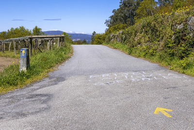
We will approach the train tracks, we find a picnic area with a fountain where we can rest and replenish water. We are going to travel 500 meters, with the train tracks on our right and we will arrive at a junction that shows 2 variants, we will take the one on the right to pass the train tracks below.
From here we go uphill and for approximately 6 kms we will pass 17 m. at 125 m. It is not the great rush of our lives… it is the typical sawtooth or Galician up and down.
We come to the cemetery and church of SANTA MARIA DE ALBA, we continue… we will cross a crossroads and we advance towards a road where we carefully turn left and pass the train tracks below.
We continue by road and we will cross a nucleus of houses upwards., shortly before reaching a roundabout, we take a small paved path to the right (next to a factory), we again approach the train tracks again and we circulated for a while under a slope below them (we have them on the right). This area is on the rise and when we pass some houses we will enter a stretch of land with a steep upward slope… on our right the slope of the train tracks… on our left the river. We will go encased by a kind of valley and a beautiful wooded path. Streams and water runs everywhere. It is uphill but the place invites pedaling and is enjoyable.
At a stop we will have to cross the train tracks (quiet it is not the main track and it does not have much traffic… I even think that they are abandoned tracks) advancing a little along the tracks (to the left) and We go back up towards the CAPILLA DE SAN AMARO, here we are already at the top and end of the climb and take up the asphalt again.
We advance through some houses and we meet directly and in front of a bar with a suggestive name “MESON DEL PULPO”, whoever wants octopus already knows ;), we continue along a street that begins to the left of this inn and it goes downhill… we pass a recreation area with benches and a fountain… (good place to stop to rest)…
A good asphalt road in descent will make us circulate happily… but be careful in a curve with views of a farm and a fork we have to go off to the right by a small ramp upwards, the love of the road and the descent it is possible that it makes us pass this detour… if that happens nothing happens, later advancing on the road in the village of A CANCELA we can retake the yellow arrows again.
The correct track will take us through the IGLESIA DE PORTELA and in this place there is also a hostel of the same name, (ALBERGUE DE PORTELA) after passing in front of that hostel we turn left and we will stop at the road narrow we take to our right. We are in a flat area where we will pedal calmly until we reach a STOP sign that will stop us to cross a road very carefully, we cross turning left and taking a dirt road ahead.
We will immediately go out onto the asphalt and we will arrive on the piste at the CROSSING OF AMONISA, we take a left, again to the left and face roads to approach the train tracks that we will be able to see above us by some high bridges, we turn right when we reach the height of the tracks and continue along placid and quiet roads heading north.
Shortly after passing through a small concentration of houses and farms (ALDEA DE A SECA) we will hit a road. If someone has a bit of time left and can afford to cross the road in front, there is access to the NATURAL PARK, CASCADAS DEL BAROSA, a very close corner with mills and impressive waterfalls on the stones, it is not far and the visit is well worth the little detour to enjoy this idyllic place.
If we do not visit the waterfalls we must cross the road carefully and turn left to advance a few meters along its shoulder.
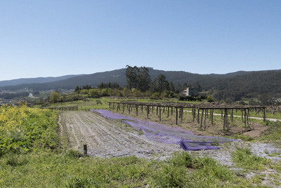
We are traveling on the N-550 and the road signs will take us to the left of this road to go in parallel approaching and moving away from the road until near CALDAS DE REIS. We are in the final section of the stage, we only have 6 km to go and if we are in a hurry we can shoot directly by road, if we want to be purists and scrupulously follow the path we will tiptoe the detours to the left of the road.
So if we continue a little further down the road at the height of a stone chimney factory with great exposure outside, we will have to turn left and exit the road.
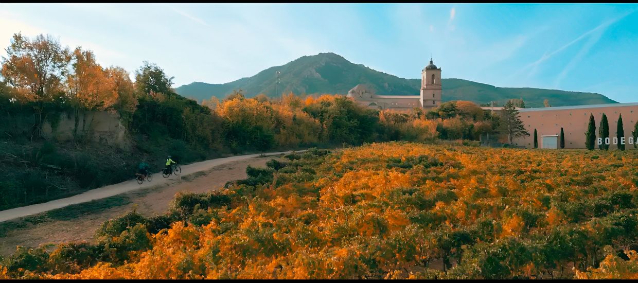
We will go down a dirt road, entering an area of high vine vines that in this area is one of the main crops and that gives the landscape a very special and picturesque tone. If we travel in the autumn months it will be beautiful.
We will leave this road and we will pass asphalt in front of some houses to approach the road again, when we are about to go by road we will realize that on our left another narrow road will allow us to advance without touching the dangerous asphalt.
It will only be a small truce, hopelessly a little further on the road will make a right turn and will take us to the road that we will have to cross and circulate along it a few meters to our left. Here, if we do not want to play it, we can carefully roll down a small dirt path on the left so that we do not have to cross the road and not be in unnecessary danger, because a little further on we will have to turn left again to leave. the asphalt.
At this road exit we access the CAPTA DE SANTA LUCIA, and from here we are going to be able to approach the nearby CALDAS DE REIS without running so much danger and on quiet neighboring roads.
We will pass some beautiful paths between vineyards and vines fastened with stones, picturesque places where more than one instagramer will be able to take beautiful photos.
This path comes a moment that approaches the highway and runs parallel… to then converge behind a pension and crossing the IGLESIA DE SANTA MARIA we return to a street on the left side of the highway that little further down, it inevitably turns us against the road and against the bridge that gives access to CALDAS DE REIS.
If our place to stay is the recommended HOTEL BALNEARIO ACUÑA, we have it right there on the left. A kind of tunnel that is on the same facade a little further back gives access to a huge central courtyard with gardens where there are some bungalow-style rooms and swimming pools. There they will tell us to go to the hotel and in that area they will tell us where to store them and where to stay.
If we are going to sleep anywhere else or even intend to do other types of stages and continue… we will only have to cross the bridge and enter the streets of the city.
On the same bridge and just below to the right is the O MUIÑO restaurant, a genuine and very special place that is highly recommended for dinner if possible.
O MUIÑO
Rúa Ferreria, 1
36650 Caldas de Reis, Pontevedra
986 54 02 25
Reflection on the Stage
At this point of the road, whether we have left Lisbon or Porto, our body will be conditioned and used to long days of pedaling.
This stage has somewhat high mileage and several complex zones. The sawtooth profile and the constant rise and fall can greatly reduce our forces.
The exit from the city of VIGO complex and somewhat exasperating… then we will go calmly down the side of the mountain. Special mention to the area after ARCADE and PONTE SAMPAIO where the Roman road is going to make us pay special attention, walk and suffer from the unevenness on the rise.
Apart from this, the end of the stage will be more comfortable and calm and once we cross PONTEVEDRA and make the climb there when leaving the city, the road will be pleasant and relatively calm until we reach CALDAS DE REIS.
It could be said that the first part of the stage is the most complicated and that luckily in the last kilometers we will be able to go more calmly and with much more comfort.
Acommodations
Bike Shops
| Kito Bike Rúa Pai Crespo, 86 36800 Redondela, Pontevedra +034 986 11 70 11 |  |
| Bicicletas Farto Av. de Vigo, 42 36003 Pontevedra +034 986 85 88 93 |  |
