You’ve planned your trip, your bike is all set, and there’s just one thing left: knowing exactly where you’re going and what you’ll encounter along the way. That’s why we created the bicigrino Camino de Santiago by Bike app. You’ll use it in two situations—at home, in front of your computer, to plan your trip; and on the Camino, with your phone mounted on the handlebars, to follow the route—and in this guide, we’ll show you how to get the most out of both.
The bicigrino app is a GPS planner and navigator designed from the ground up for cycling the Camino de Santiago. It’s not a tool for hikers that’s been shoehorned into the role: it identifies the type of surface on each section, shows you repair shops along the route, alerts you to elevation changes before you encounter them, and—most importantly—keeps working even where there’s no cell service.
It’s a single app that adapts to your screen. On your computer, you have plenty of space to plan at your own pace; on your phone, you have the route version—lightweight and ready to navigate with one hand. And since it’s a web app, you don’t need to install anything to get started: just go to planificador.bicigrino.mobi, and you’re all set.
Let’s take a look at the entire journey, from the living room to the handlebars.
Part One: At Home, on the Computer
The best time to plan is before you head out, when you have plenty of time and a cup of coffee by your side. On the computer, you can view the map in full size, compare different routes, and adjust your stops without feeling rushed. That’s the way to do it.
1. Come in and choose your path
Open planificador.bicigrino.mobi in your browser. The first step is to choose a route. For now, the app covers the two routes we know best and that people ask us about most often:
- French Way, from Saint-Jean-Pied-de-Port to Santiago (about 780 km).
- The Portuguese Coastal Route, from Lisbon to Santiago (about 639 km).
You choose where you start and where you want to go. You don’t have to do the entire route: if you only have a week, you can start in León, Burgos, or Porto and plan your own section of the route.
2. Tell them how many days you have and let them break it down into stages
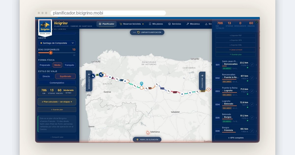
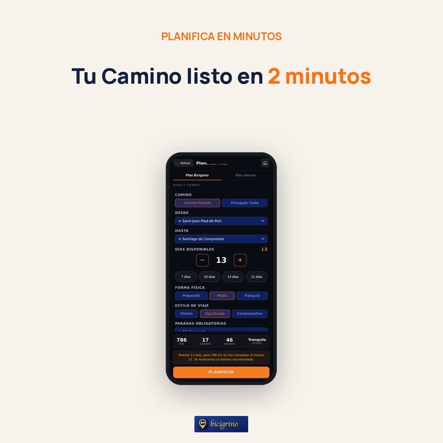
This is the heart of the app. Adjust the selector for the number of available days —seven, ten, fourteen, or however many—and the planner will suggest a balanced breakdown of stages, including distances and elevation changes, with stops in real towns that offer real services.
You can fine-tune the distribution with three simple adjustments:
- Fitness level (fit, average, out of shape): This determines how hard the cast is willing to push you.
- Travel style (direct, balanced, contemplative): whether you prefer to arrive early or enjoy the journey.
- Stopovers: Decide on the places where you definitely want to stay overnight.
Once you’ve done that, tap “Plan.” At the bottom, you’ll see a summary of the trip: total kilometers, number of stages, average kilometers per day, and pace. If you select fewer days than recommended, the app will let you know and offer sensible alternatives—it won’t leave you with an impossible plan.
3. Customize it to your liking
Would you rather decide for yourself where you sleep each night? You can do that, too. In manual mode, you can change the end of each day, lengthen or shorten a stage, move a stop… and the plan automatically recalculates everything accordingly. Bicigrino’s official stops are marked with a star, because these are the places where we know from experience that you’ll be well taken care of.
4. Set up your bike
The app doesn’t make any assumptions about your bike. You choose from the five types we support—mountain, gravel, electric with front suspension, full-suspension electric, and AMFLOW—and, if it’s an electric bike, you specify the brand, model, and battery. With that information, the effort and range estimates are tailored to the bike you’re actually riding. On the French Way, you can also activate Asphalt Mode: an alternative route that avoids dirt sections and sticks to roads and paved trails, ideal if you’re riding a road bike or pulling a trailer.
5. Look at the map and the elevation profile
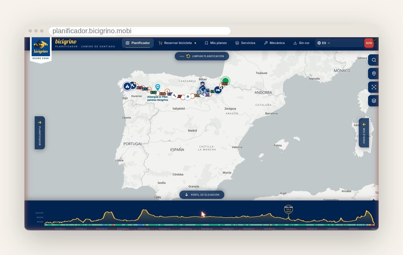
Once the route is calculated, the map shows you the entire route and an interactive elevation profile at the bottom. Hover your cursor over the profile, and you’ll see the exact elevation and gradient at each point, synchronized with a marker on the map. That way, you’ll know where the long climbs are before you hit them.
From the layers panel, you can turn on and off whatever you want to see on the map: repair shops, water sources, lodging, supermarkets, pharmacies, difficult technical sections, and road surface types, each color-coded.
6. Review each step one by one
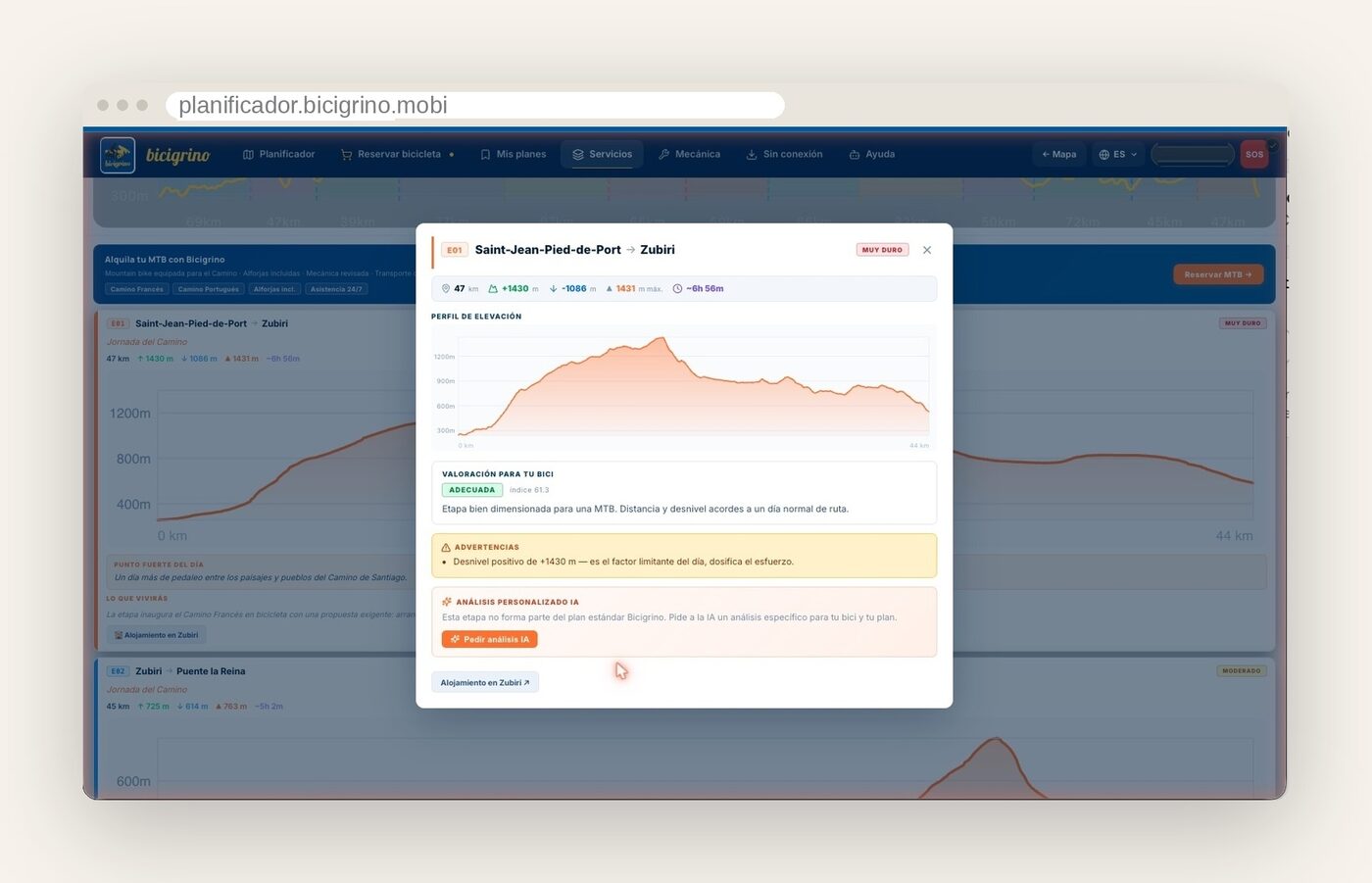
In the “My Stages ” panel, you’ll find the complete list of stages. Open any one to view its profile, stage alerts, road surface type, nearby repair shops, stops with the bicigrino Seal, and an AI-powered analysis that tells you “what you’ll experience” on that stage. If you’re riding an e-bike, it also estimates your range; if you’re riding a regular bike, it estimates the expected effort.
7. Save your plan and download it
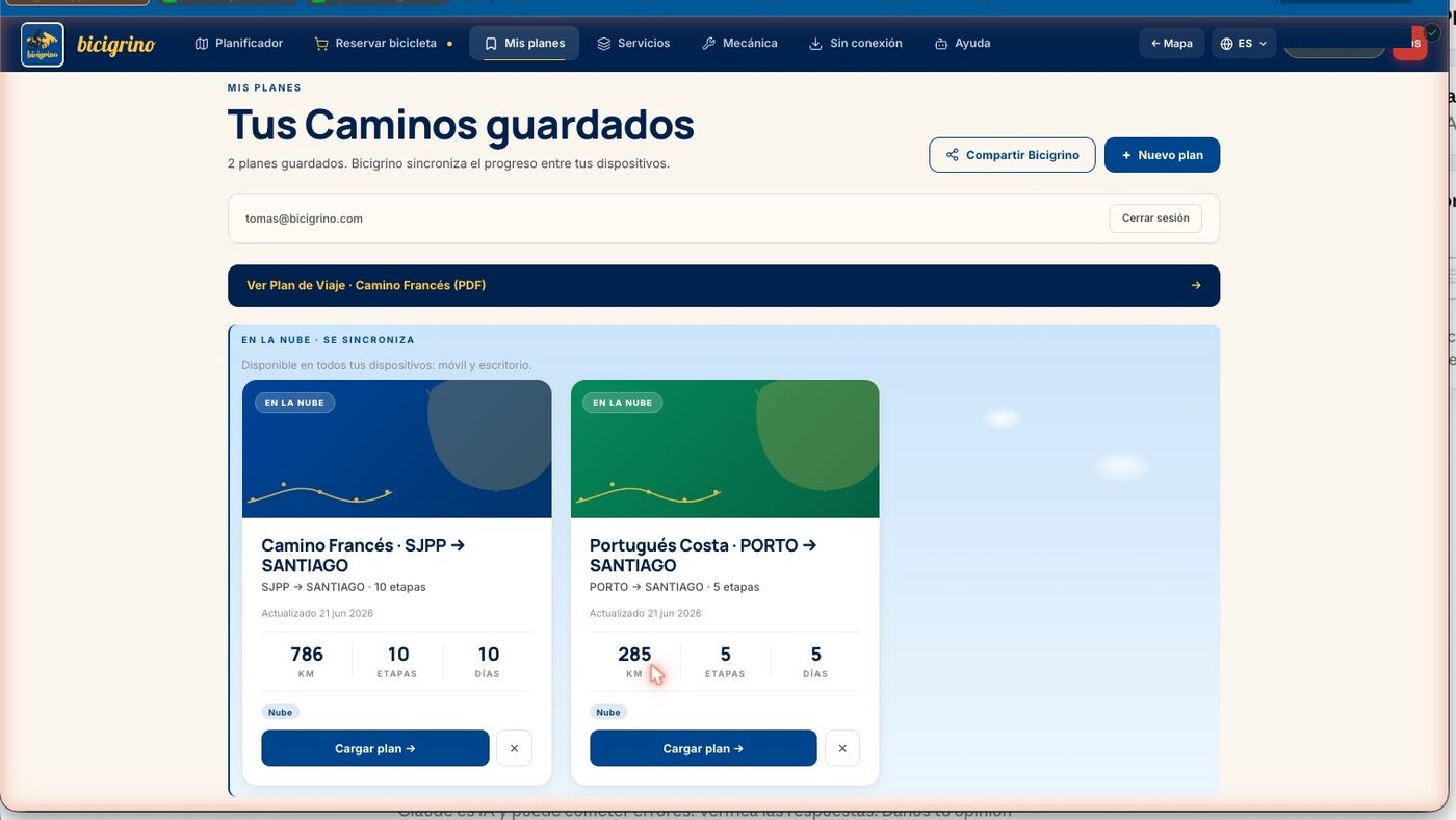
Once you’ve planned your trip, save it with your email address (you’ll receive a magic link to access it—no passwords to remember). From there, the itinerary you create on your computer will appear on your phone, and vice versa. You can also download it as a PDF to take with you in print or on your device, or export the track in GPX and KML formats if you want to use it on a handlebar-mounted GPS device like a Garmin.
8. While you’re at it, check out the services and reserve a bike
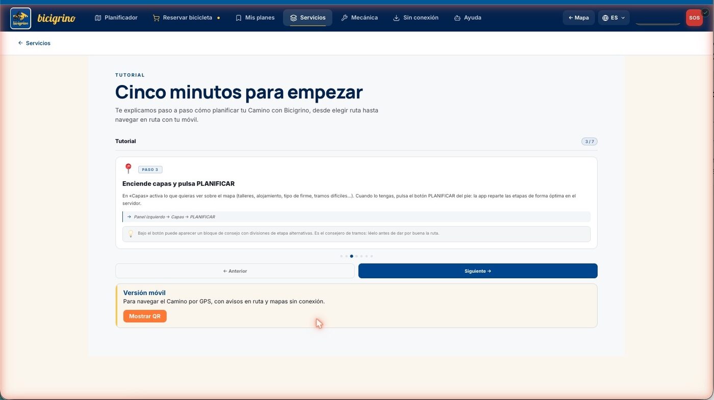
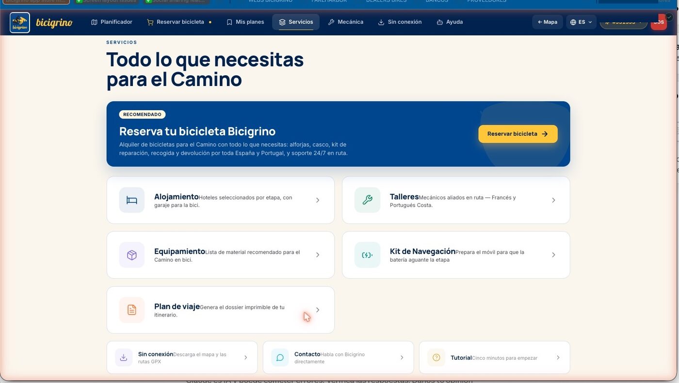
The computer is also a great place to take care of everything else. Under “Services,” you’ll find a list of verified partner workshops, hotels for each stage, recommended gear, and the travel plan dossier. And if you don’t have a bike yet, under “Reserve a Bike,” you can arrange your e-bike, luggage transport, and assistance for the dates of your Camino.
Questions? Ask Estela
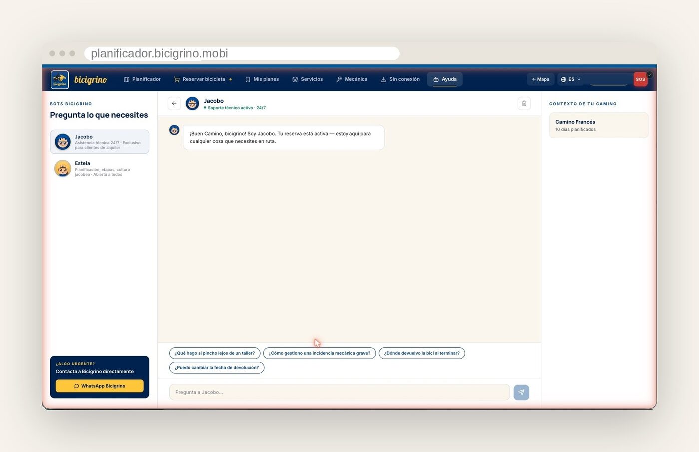
If at any point you’re not sure which way to go, Estela, our Camino advisor, is here to help: she’ll assist you with planning, the stages of the route, and the local culture—it’s free and open to everyone. And if you’re a bicigrino customer with a reservation, you’ll have access to Jacobo, our premium technical support service for any unexpected issues that may arise during your trip.
The Bridge: Brings Everything to Your Phone
Plan created and saved. Now it’s time to transfer it to your phone, which is the device you’ll have with you on the trail. There are three ways to do this, and they’re all simple:
- Log in on your phone using the same email address: your saved plan will appear automatically.
- Scan the QR code provided by the app on your computer, and the plan will instantly appear on your phone.
- Or just open the same URL— planificador.bicigrino.mobi—in your mobile browser.
Here’s an important tip: install the app on your phone. Since it’s a progressive web app, it adds itself to your home screen just like any other app—without going through an app store—and launches instantly when you tap its icon. And before you leave home, while you’re connected to Wi-Fi, download the map of your Camino so you can use it offline (you’ll find it in the “Offline” section). That’s the trick to making sure you don’t get stranded in the middle of the Meseta.
Part Two: On the Camino, with My Cell Phone
The day has arrived. Your phone is mounted on the handlebars, the sun is in your face, and you have only one hand free. The mobile version is designed exactly for this: large buttons, no menus to get in the way, and no pop-up windows while you’re riding.
1. Your Home Screen
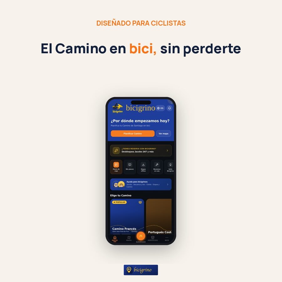
Below, you’ll find a bar with five sections: Home, Map, the central Navigate button, Services, and More. From Home, you can view your route, see your next leg, and quickly access your trip log, offline maps, the mechanics section, and the Stamp. The orange button in the center, with the double yellow arrow, is the one that turns on GPS navigation.
2. Retrieve or set up your plan
If you saved the itinerary at home, here it is, already loaded, with all its stops. Tap any stop to view its details, hotel reservation, downloads, and the “Navigate” button. Didn’t plan ahead? No problem: you can create the itinerary on your phone just like you would on a computer.
3. Start browsing
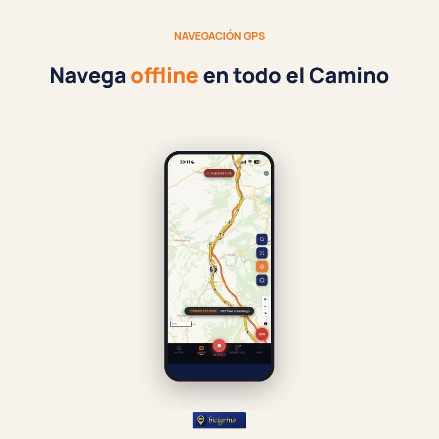
Tap the central “Navigate” button. You can start navigation in two ways: by following a specific stage of your plan, or in free mode along the entire Camino (choose the French or Portuguese route and hit the road). The app shows you the route track and your location in real time.
While riding, the screen acts as a great co-pilot: the map rotates in the direction you’re heading, follows you as you pedal, and—if you lose focus— alerts you when you veer off course or are riding in the wrong direction. A small widget at the bottom keeps the remaining kilometers, your speed, and the elevation gain in view, without covering the map.
4. The Data That Really Matters on the Road
Here’s the key difference. As you ride, the app gives you something that only cyclists truly appreciate:
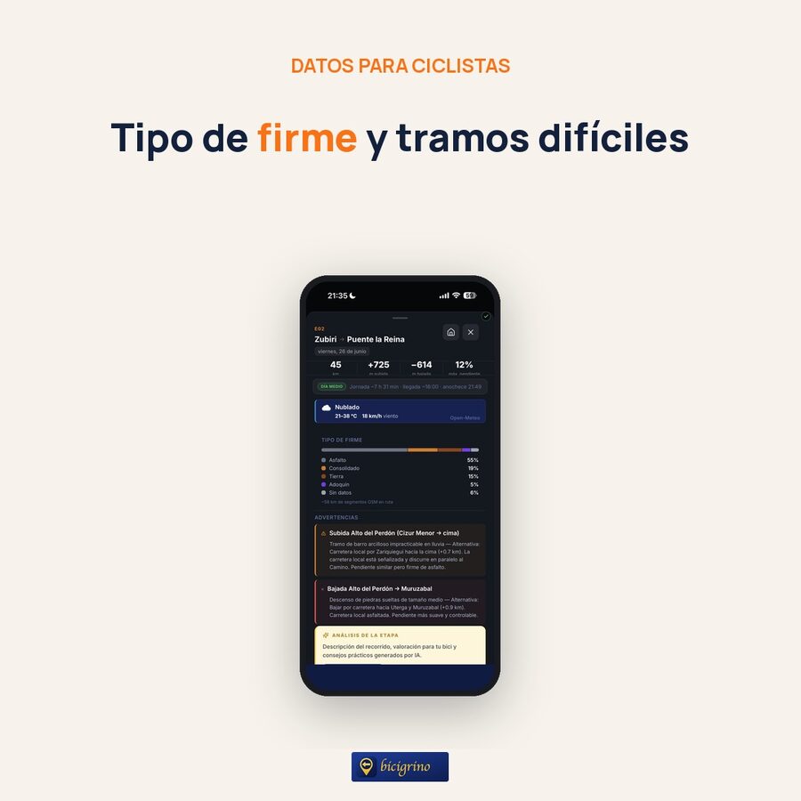
- The type of surface on each section—asphalt, compacted dirt, dirt, cobblestone, sand—and the marked technical sections. Knowing that loose sand is ahead completely changes how you tackle it.
- The actual elevation gain for each stage, so you can pace yourself wisely.
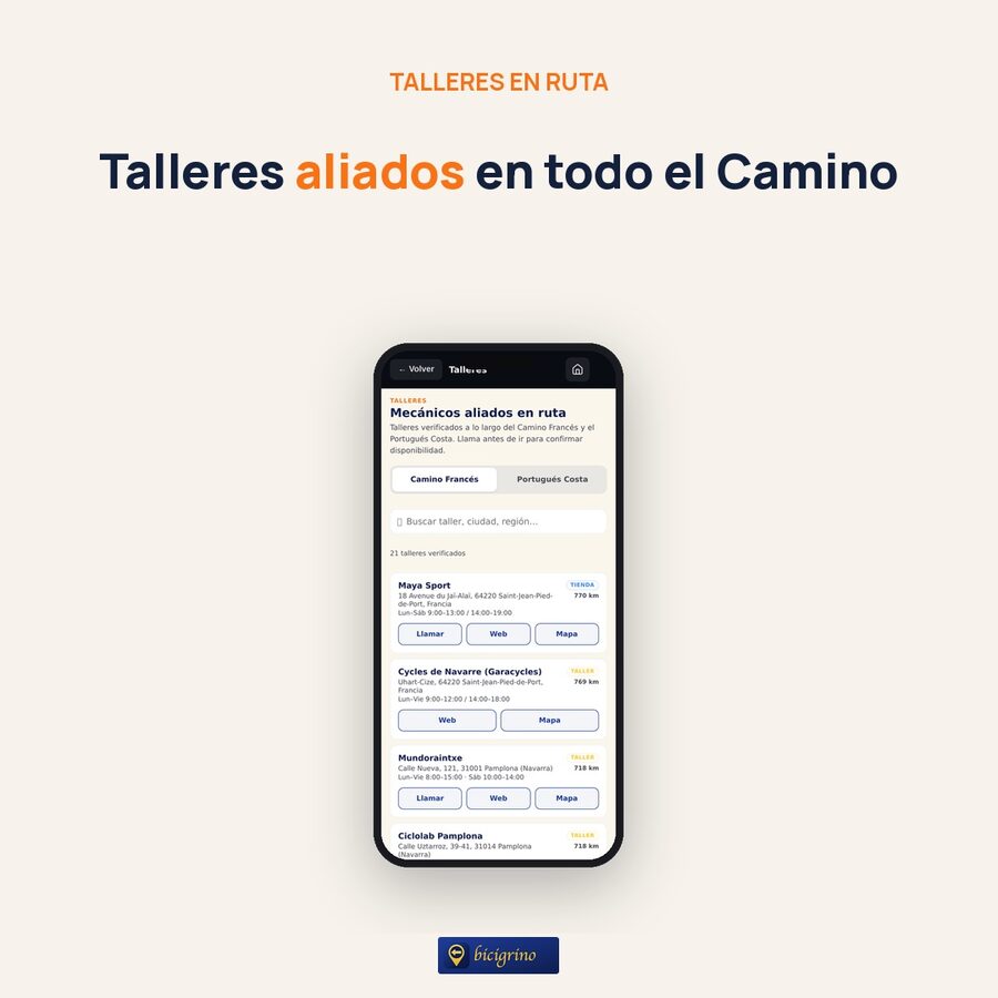
- Verified bike shops and repair shops along the route, with their locations. When something goes wrong, you’ll know where the nearest one is.
- Accommodations with the bicigrino Seal and daily services—water, pharmacies, stores—are shown on the map. The app discreetly notifies you when you pass near a featured stop.


5. It keeps working even without coverage
This isn’t just a minor detail—it’s one of the reasons we created the app. The Camino passes through areas where cell service is unavailable for hours—the Meseta, the mountains of León, and much of Galicia. If you downloaded the map before setting out, you can keep navigating even if you run out of data: the map, your location, and the track are still there. And when something requires a connection, the app clearly lets you know instead of leaving you with a blank screen.
6. If you stray from the plan, recalculate from where you are
Some days you have extra energy and go further; other days you feel like stopping sooner. The app understands this: it detects when your actual route has deviated from the planned one and offers to recalculate the stages from where you are, with just one tap. The plan adjusts to your Camino, not the other way around.
7. And if something goes wrong: SOS and Support Vehicle
For serious emergencies, you can use the SOS button, which shares your location and the nature of the problem with the bicigrino team. And if you’re traveling with our Support Vehicle, you can share your location and track the fleet from the “More” section. Peace of mind for you and your loved ones.
In short: The Camino de Santiago by Bike app, from start to finish
Plan your route at home at your own pace, save the plan, transfer it to your phone, and once you’re on the road, all you have to do is follow the arrow. The same tool for both stages of the trip, created by people who know these routes kilometer by kilometer.
The app is constantly evolving, and we’re expanding it every month: more routes, more data, more details. Try it out, plan your next Camino, and let us know what you think is missing; every suggestion helps us improve it for the next one.
Before you get started, you might also find our guide to the 7 keys to planning the Camino de Santiago by bike helpful.
Start planning your Camino
Go to planificador.bicigrino.mobi from your computer or phone, choose your route and dates, and put together your plan in just a few minutes. It’s free, and you don’t need to install anything to get started.
Want to know the story behind why we created this app? We’ll tell you all about it in “We’ve created the Camino by Bike app we’ve been dreaming about for twenty years.”
The best way to prepare for the Camino by bike is with someone who knows it well. See you on the trail.